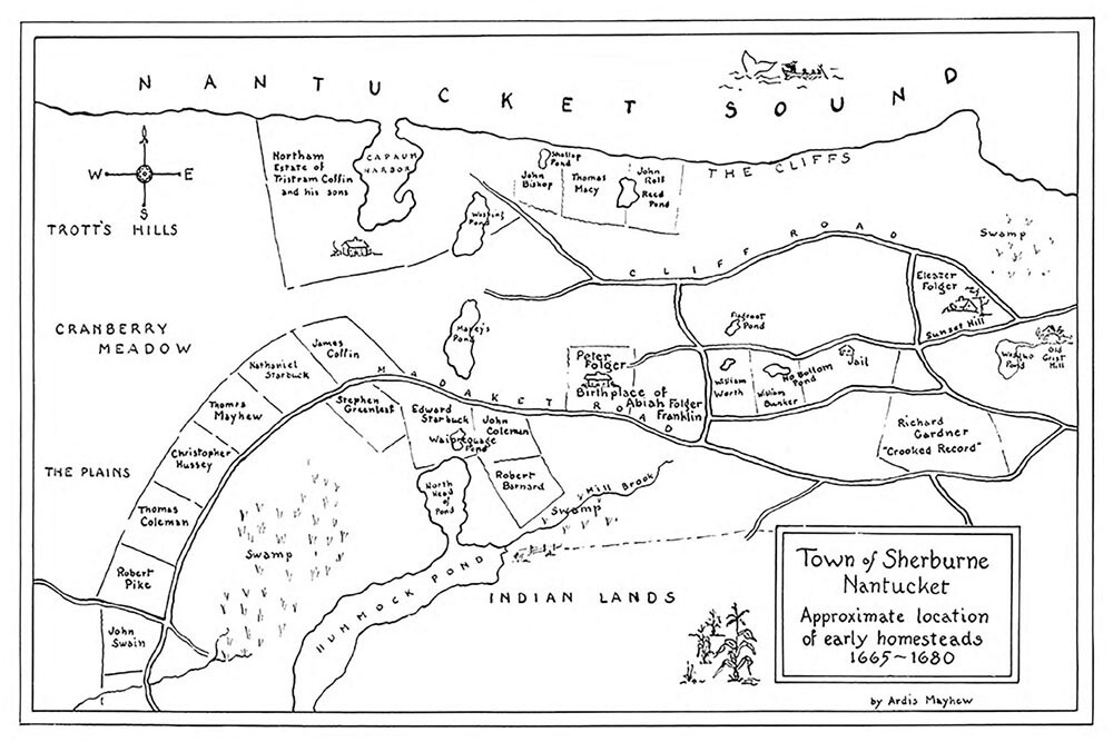
Mayhew Map of the Town of Sherburne Nantucket, 1665-1680 12x18
$15.00
In stock
Save this product for later
Product Details
From our 12" x 18" digital print collection:
Circa 1900 reprint of a map of the Town of Sherburne Nantucket, Approximate location of early homesteads 1665-1680.
Plat shows location of homesteads of early settlers. Lots for: John Swain, Robert Pike, Thomas Coleman, Christopher Hussey, Thomas Mayhew, Nathaniel Starbuck, James Coffin, Stephen Greenleaf, Edward Starbuck, John Coleman, Robert Barnard, Peter Folger (birthplace of Abiah Franklin Folger), William Worth, William Bunker, Eleazor Folger, Richard Gardner, Tristram Coffin, John Bishop, Thomas Macy, John Rolf. Also shows: old grist mill, jail, Sunset Hill, Cranberry Meadow, Trott's Hills.
Mayhew Map of the Town of Sherburne Nantucket, 1665-1680 12x18
Display prices in:USD
